Avoid project delays with our experienced measured surveyors
Our 35+ years of experience provides us with great expertise, skill and knowledge about measured surveys and building projects.
Working with us means that our expert team with relevant experience will handle your project so you can get the data needed to build an information model and focus your time on creativity or management.
We get the data right the first time and provide efficient delivery with a commitment to your working timescale. Keeping to timescales allow you to avoid rising costs, reworking your project and delays.
Have a surveying question?
Take a look at our FAQsRichard Griffiths, Director, Savills
The CADS team efficiently conducted a laser scan survey, ensuring minimal disruption to our operational building. The quick turnaround to provide the deliverables was impressive. I would recommend their services for any project requiring reliable and precise building data.
Our process to get the data you need quickly
Collaboratively working with our clients allows us to develop the survey specification before undertaking complex surveys of individual buildings or large estates.
After contacting us via email or phone, we will undergo an initial consultation with you to understand your requirements. Send us through drawings and other useful project information so we can get a better idea of your project.
Within a week of contacting us, we will undergo a site visit to determine a quote or we may determine your quote based on the information given.
After the go-ahead is given, our surveyor is on-site in 2-3 weeks.
Our previous projects were delivered swiftly to meet deadlines. A few examples include:
Specific survey services for your specific needs
Complete your project efficiently and on budget with our range of complementary survey services for your specific needs.

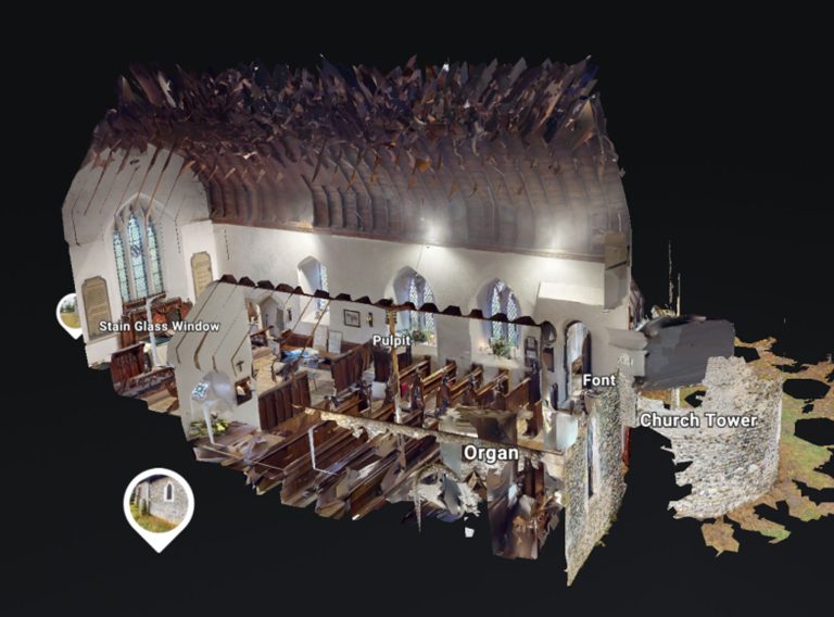
Get accurate results with our 3D laser and point cloud surveys
Our highly experienced surveyors will conduct 3D laser or point cloud surveys to ensure you have all the spatial information and 3D modelling you need.
Laser surveys & point clouds
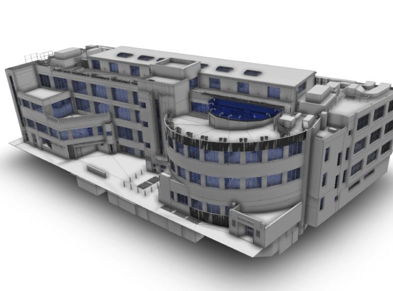
Get highly accurate Revit® building models for your BIM project
Receive highly accurate Revit® building models which ensure the success of your BIM (Building Information Model) project.
Revit® modelling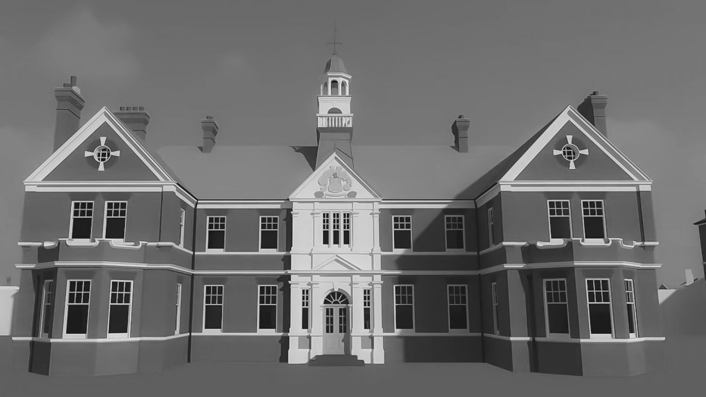
Detailed and accurate measured building surveys
Get detailed and accurate measured building surveys whether your project is in the UK or Europe.
Measured building surveys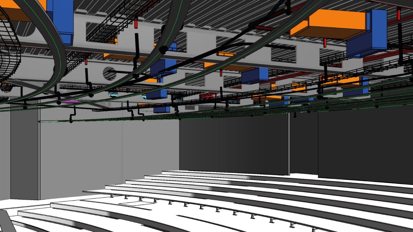
Get highly accurate surveys for your BIM project
Acquire an accurate base model for BIM projects for architects to use as the foundation for designs.
Surveys for BIM
Drone land surveys
Map the natural physics and features across vast sites with a fast and cost-effective UAV drone survey from CADS.
Drone Land Surveys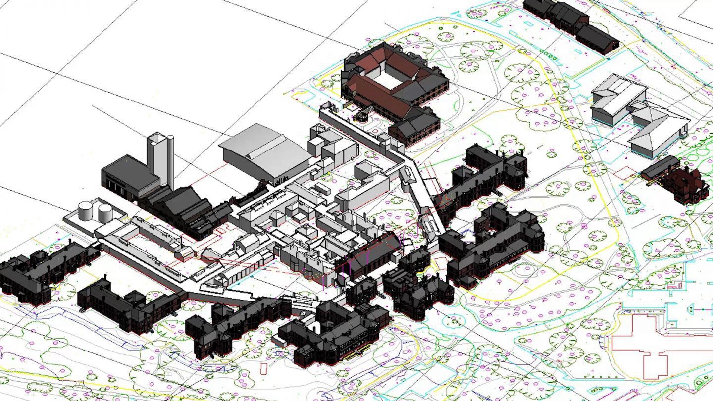
Get accurate topographical surveys in the UK
For your development project, receive accurate topographic surveys from our experts mapping the site, its features and topography.
Topographic surveys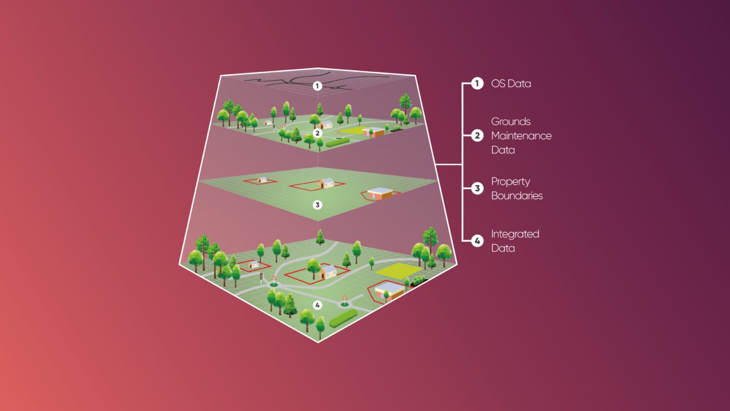
GIS & asset mapping
We provide cost and efficiency saving in asset management by helping clients create, maintain, update and analyse asset information within a Geographic Information System (GIS).
GIS & asset information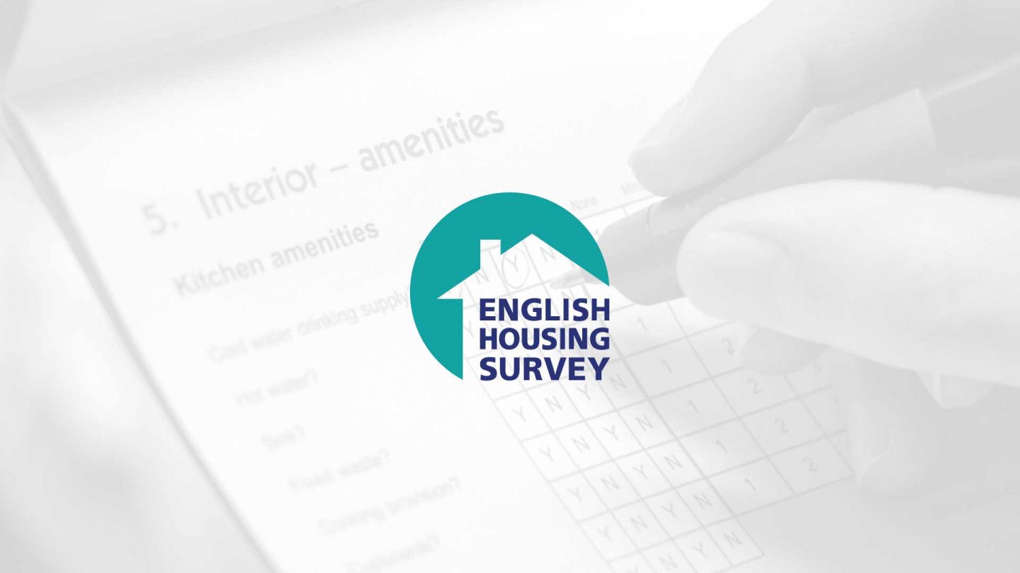
English Housing Survey
CADS plays a key role in fulfilling the Government-commissioned English Housing Survey. This long-running survey records details about the condition of the country's housing stock.
English Housing SurveyWho we work with


Ready to get your project started?
Design your best work with a team of technical experts behind you by speaking to one of our surveying experts today. We’re happy to help and answer any questions! Simply fill in the form and we will get back to you.
Case studies
Alternatively, take a look at our client base to see how we’ve been trusted on a variety of projects.
 16/08/2023
Case Studies
16/08/2023
Case Studies