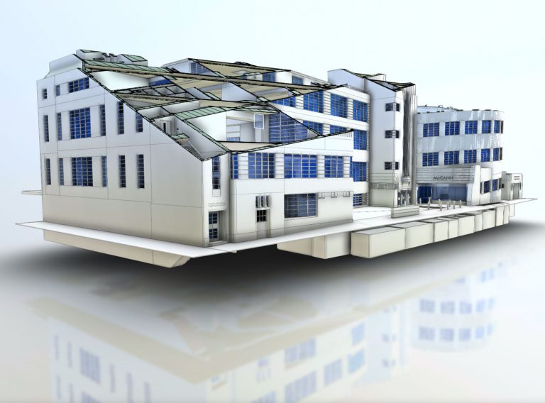
Get highly accurate Revit® building models for your BIM project
Receive highly accurate Revit® building models which ensure the success of your BIM (Building Information Model) project.
Revit models
Acquiring site data & creating 3D models of physical assets is referred to as 'Reality Capture' and this article discusses the value it will add to your project
Scroll
Reality Capture describes the digital processes for acquiring site data and creating 3D models of a physical asset and can combine several alternative data sources including LIDAR (terrestrial and/or airborne), photogrammetry and GIS.
Reality Capture is the most cost-effective method for acquiring critically important, complex site data, and by enhancing it with additional layers of information you can create a virtual ‘Digital Twin’ of your assets.
The real value of Reality Capture is realised when the data is incorporated with a BIM workflow and 3D modelling software, to create accurate, reliable, real-time facsimiles of your assets.
When correctly maintained the Digital Twin can continually inform your strategic and business decisions and improve planned maintenance programming. It will also enhance collaborative working, democratise access to important data and deliver technical, visual and performance data throughout the lifecycle of the asset.
However, to be useful and reliable Reality Capture data still needs to be collected, created and managed with the same care and methodical approach employed on a traditional measured survey.
When considered early enough, and built into the project programme, Reality Capture can prepare large amounts of data, speed up the acquisition of that data, with improved accuracy. It also reduces the potential for human error in the process and therefore minimises the need for costly return visits to site, and additional surveys.
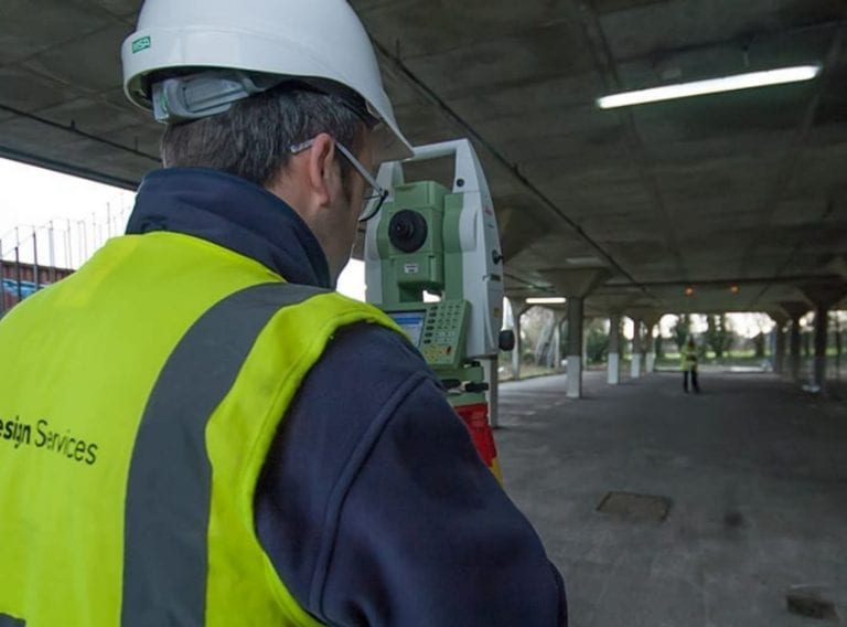
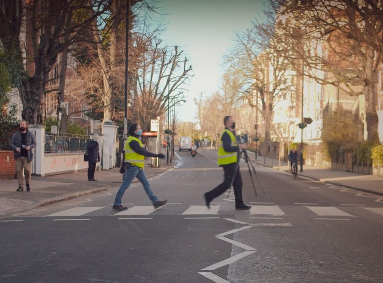
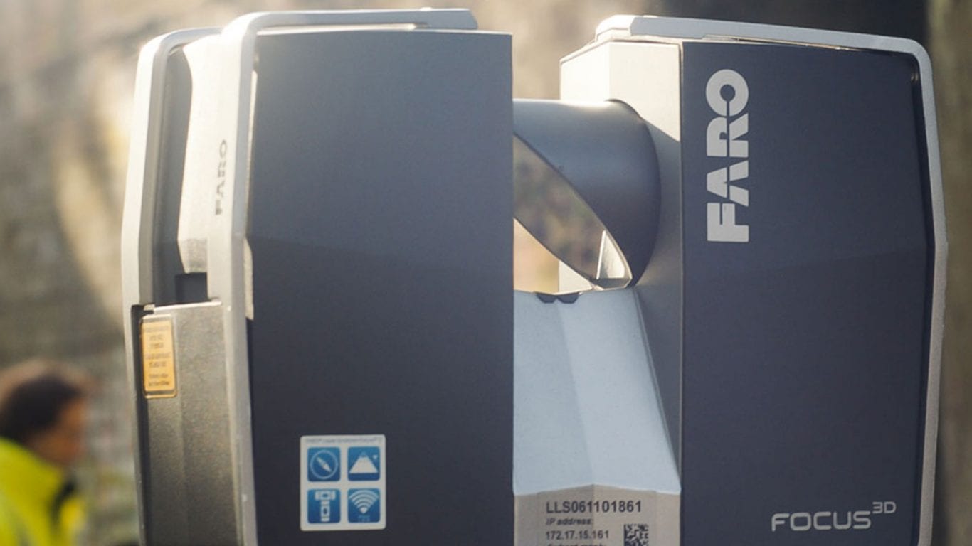
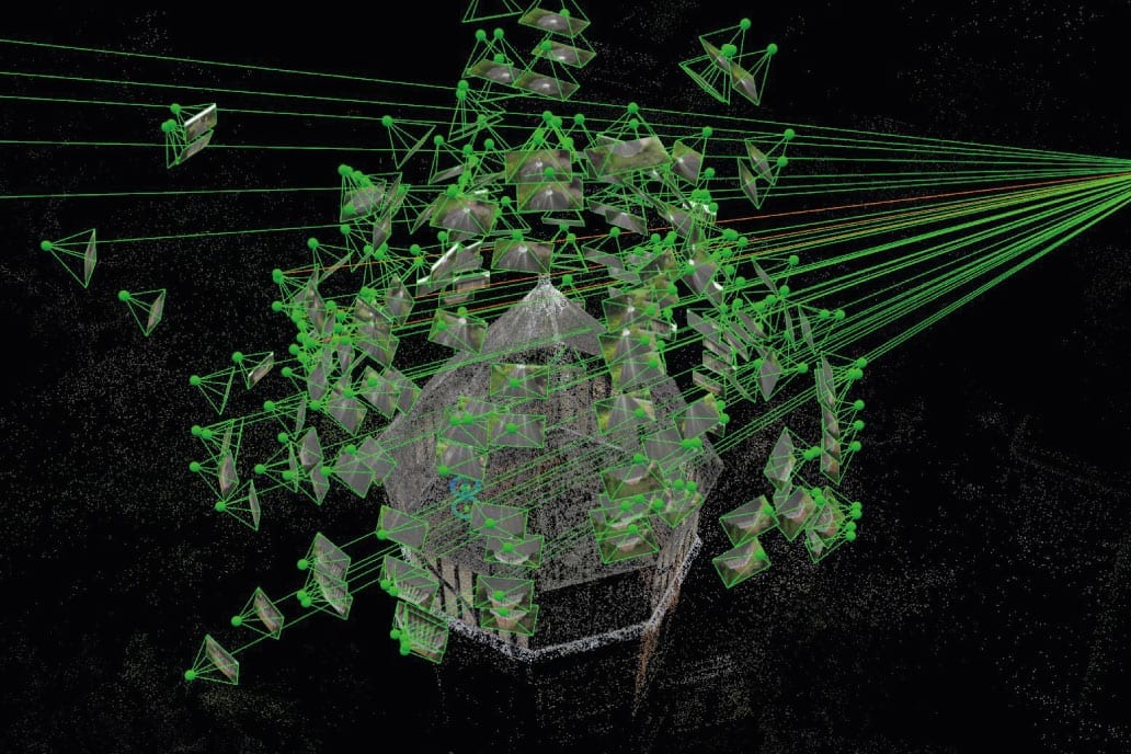
Reality Capture models can be built using a combination of active and passive data. Active data is captured using laser-scanning and mobile mapping, and passive data via photogrammetric technology. These technologies enable the CADS’ surveyors to precisely measure and process large quantities of site information faster than ever before.
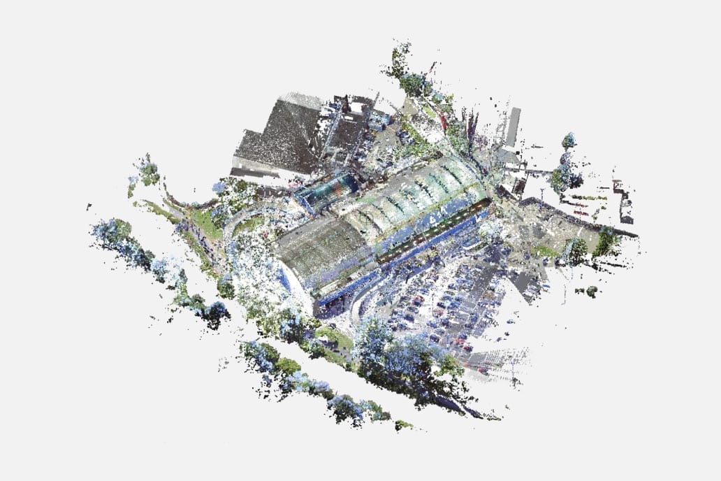
Point clouds are the most widely used output from both laser scanning and photogrammetry software. A native point cloud data file contains millions of 3D reference points, which are processed and registered into various file formats including Recap (.rcp), or open .las (LASer) format, textured maps and even simple .e57 or text file formats.
A point cloud dataset is a digital file containing X, Y, and Z coordinates and RGB values for each individual reference point. These datasets can range in size from a few hundred megabytes to files containing 100s of gigabytes of data, which means that Cloud-based solutions are preferable, as they facilitate faster access and manipulation.
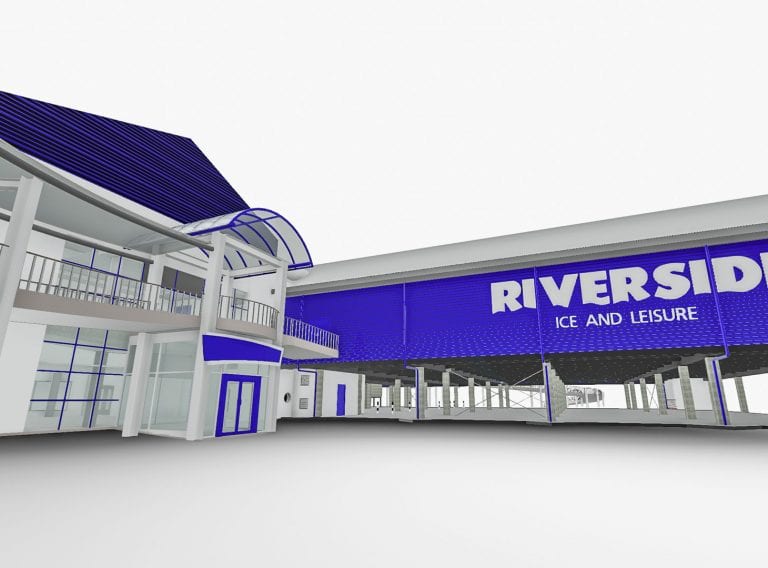
Point cloud data sourced from LIDAR technology can be combined into a single Point cloud dataset and used as a cloud-based visualisation and measurement tool or prepared as 3D BIM architectural or survey model in software such as Revit.
This creates an as-existing real-time dataset storing information about size, geospatial location, construction, condition, technical specification, and performance, allowing the data to be interrogated further as needed.
To realise the real value of Reality Capture, asset owners and/or facility managers need to invest in commissioning the highest quality of data that they can afford. They then need a strategy to add additional information to the model making it their primary source of data and then ensure that it is kept up to date. While this requires an initial investment, it will save money in the long-term by avoiding the need for multiple surveys every time you appoint designers, engineers and contractors to undertake works or maintenance.
By taking control and ownership of the data, a client can avoid unforeseen costs that arise from assumptions based on inaccurate or incomplete information, reduce the need to over-specify or price in large contingencies to cover unknown or unconfirmed scope items, as well as largely eradicating errors in design and construction because of better co-ordination that can cause expensive delays.
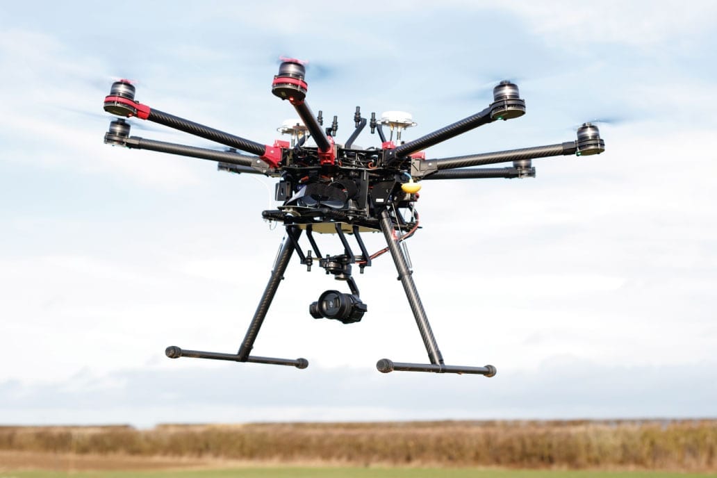
Image: Copyright Overdrones.com
Accurate site data is the cornerstone of modern digital workflows and recording the information in 3D modelling can ensure that you are always working from reliable information. Normally the prohibiting factor that clients cite is the cost of acquiring the original datasets, but this can be addressed by switching to digital record in a phased and strategic manner alongside developing suitable policies, standards and maintenance regimes for all information, databases and models.
This original data can be made ‘virtually’ available to any stakeholders by using new collaboration tools like BIM 360 and other CDE (Common Data Environments).
Centralised storage means that information is always available and accessible, automatically reducing the need for repeated surveys to collect the same data again and again over subsequent years. It also means that one version of the truth is held minimising ambiguity and improving commutations, reducing correspondence, unnecessary documentation and administration when managing a project or facility.
These digital environments are not only a secure way to store the information but also the fastest way to retrieve it resulting in faster resolution of questions and problems. The re-use of acquired data records multiple times delivers long-term value and return on investment.
For example, every time an asset is refurbished a survey of the base building is required. However, if the survey of the building post-strip out is held for use in future refurbishments, design proposals can be prepared quickly and with confidence in the knowledge that they are based on accurate information. This re-use of data helps shorten project design time as well.
To better understand the individual strengths that laser scanning and UAV photogrammetry have, here is a quick breakdown.
UAVs or drones are best used to cover large, potentially difficult to access or potentially dangerous areas and are excellent at acquiring high-quality still imagery and/or live video. Photometric data can be processed in post-production software to prepare Point Cloud datasets and linked with terrestrially acquired Point Cloud data to develop a single source of information from which to prepare 3D models. However, UAVs must be flown by a professional operator and may need to incorporate robust surveying techniques, such as control networks, if they are to be used for engineering, architectural design or construction purposes.
Laser scanners provide highly accurate and detailed data at very high tolerances, so they are generally employed for capturing detailed facades, interiors and/or confined, tight spaces, or projects where dimensional accuracy or levels are critical.
Get the data you need for your project – in the right format, at the right level of detail.
Laser Surveys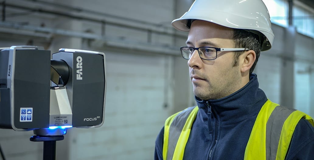
The time taken to scan a site varies depending on its size, design and construction, but it often takes less than a week. Once the reality capture is complete, we begin building the model which has no set time frame as it depends on your specific requirements regarding the level of detail needed and the complexity of the site. For models requiring the highest level of detail, if we are on-site for a day, it takes another day to process the data then six days to build a model. Therefore, as a general guide, if we are on-site for a week then it’s a week for data processing and six weeks to prepare a highly accurate model.
We scan a wide variety of sites. Mostly, we complete measured building surveys and often topographic surveys of the land the building sits on. This could be any type of building from commercial offices, supermarkets, shopping centres, blocks of flats, museums and sites of historic interest. We have the recourses to complete a wide variety of surveys in varied locations, it all depends on what the individual client needs.
Receive highly accurate Revit® building models which ensure the success of your BIM (Building Information Model) project.
Revit models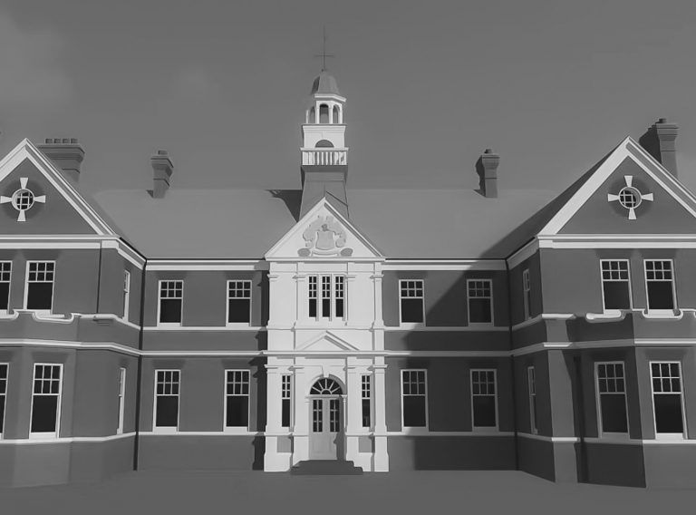
Get detailed and accurate measured building surveys whether your project is in the UK or Europe.
Measured surveys