Receive accurate and reliable measured surveys for your building project
Working on complex projects or multiple locations, our measured surveyors work across the UK and internationally.
Measured surveys
The 2.12 hectare site included a large supermarket and 26 retail units and an 18th-century historic mill
Scroll
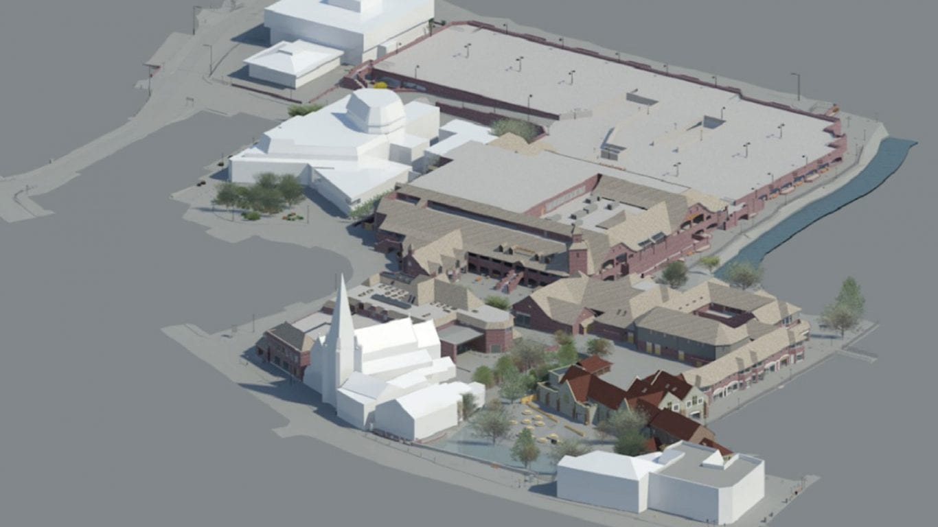
The Maltings is a retail development situated to the northwest of Salisbury city centre. The site is characterised by the presence of the River Avon and Mill Stream which runs adjacent to and directly beneath the development.
The site was purchased by a new owner who had plans to regenerate and improve the riverside quarter, strengthen the retail offering and develop an attractive extension to the café and restaurant areas.
The Maltings site covers 5.23 acres (2.12 hectares). The survey consisted of a large supermarket and 26 various sized retail units with a mix of national, local and tourist-focused retailers totalling approximately 8,500 sq m.
The site also encompassed the 18th Century historic mill which has recently been redeveloped into a public house and residential accommodation, along with a further 10 apartments and a two-story car park.
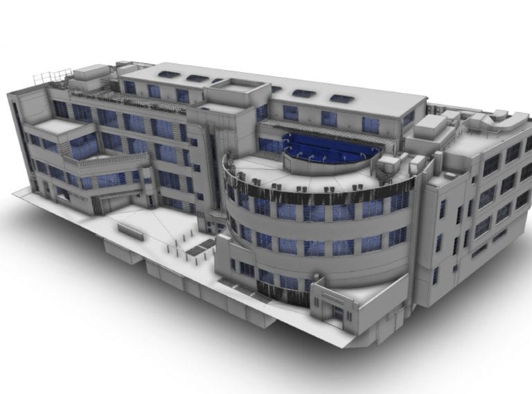
The client’s instruction was to deliver a full topographic site survey and traditional 2D floor plans of all retail units and apartments together with a detailed (LOD 2) 3D model of the site and all buildings both internally and externally. We were also required to conceptually model and provide detailed 2D elevations of adjacent buildings to capture the context of the location.
Read about the topographic and laser survey of this vast 10-hectare site for the Head of Estates at the North East London NHS Foundation Trust.
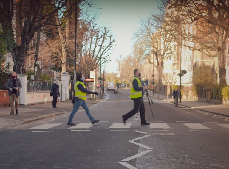
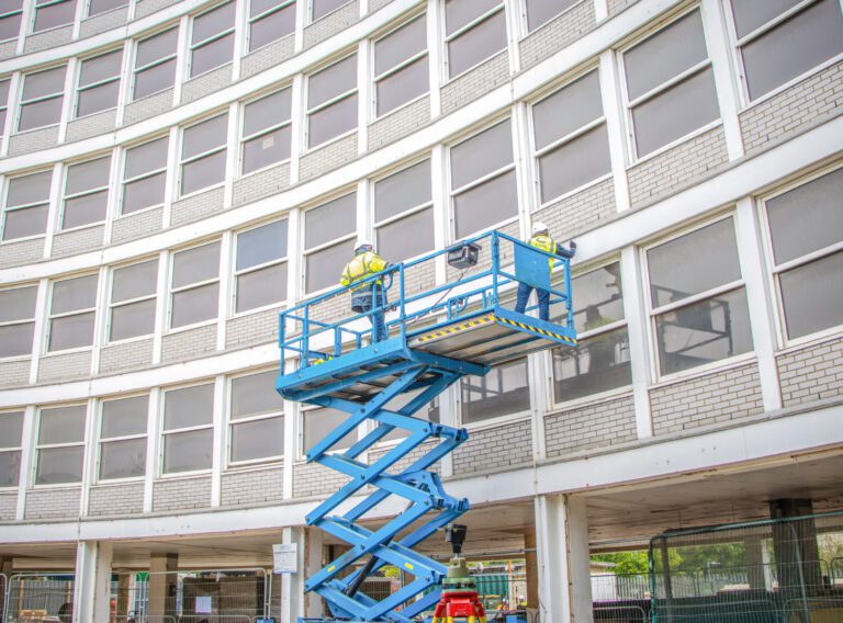
Read case studyGiven the scale and nature of the site, CADS employed a range of survey methods to effectively record the required survey information. The site topography, floor levels and control network were established using a robotic total station and GPS positioning.
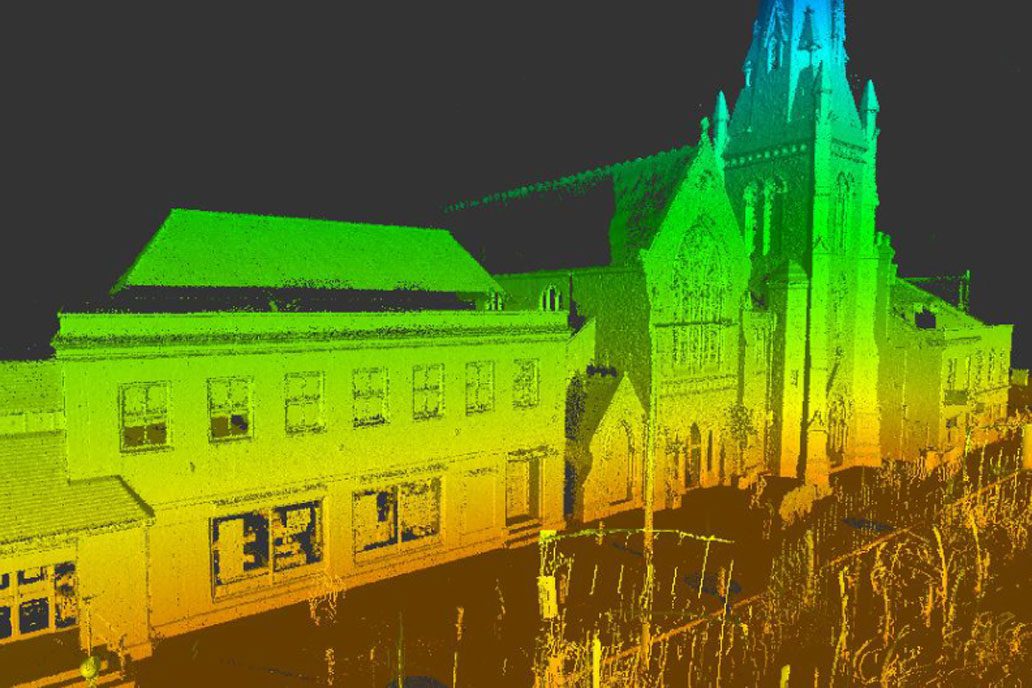
While HD 3D laser scanners were used to accurately measure the external facades of the retail units and surrounding buildings. They were also used to measure the internal details of the larger and more complex retail units and the public house. Approximately 750 scans were captured in total.
CADS also used traditional hand measurement for the majority of the smaller retail unit interiors. This was generally less disruptive and more efficient for the compact store layouts, cellular back of house areas and enabled the retailers to remain open for trading throughout the survey.
Together, four surveyors took three weeks to complete the site topography and building surveys.
The 3D point cloud data, traditional building measurements and site topography were successfully integrated to construct the detailed 3D Revit® models and enable the extraction of the 2D plans and drawing deliverables.
Approximately 6 weeks were spent modelling the site, with multiple surveyors collaborating on the model simultaneously. The completed 3D models and 2D drawings were delivered to the client on time to the agreed budget.
Talk with one of our experts
Working on complex projects or multiple locations, our measured surveyors work across the UK and internationally.
Measured surveys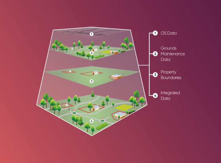
We provide cost and efficiency saving in asset management by helping clients create, maintain, update and analyse asset information within a Geographic Information System (GIS).
GIS & asset mapping